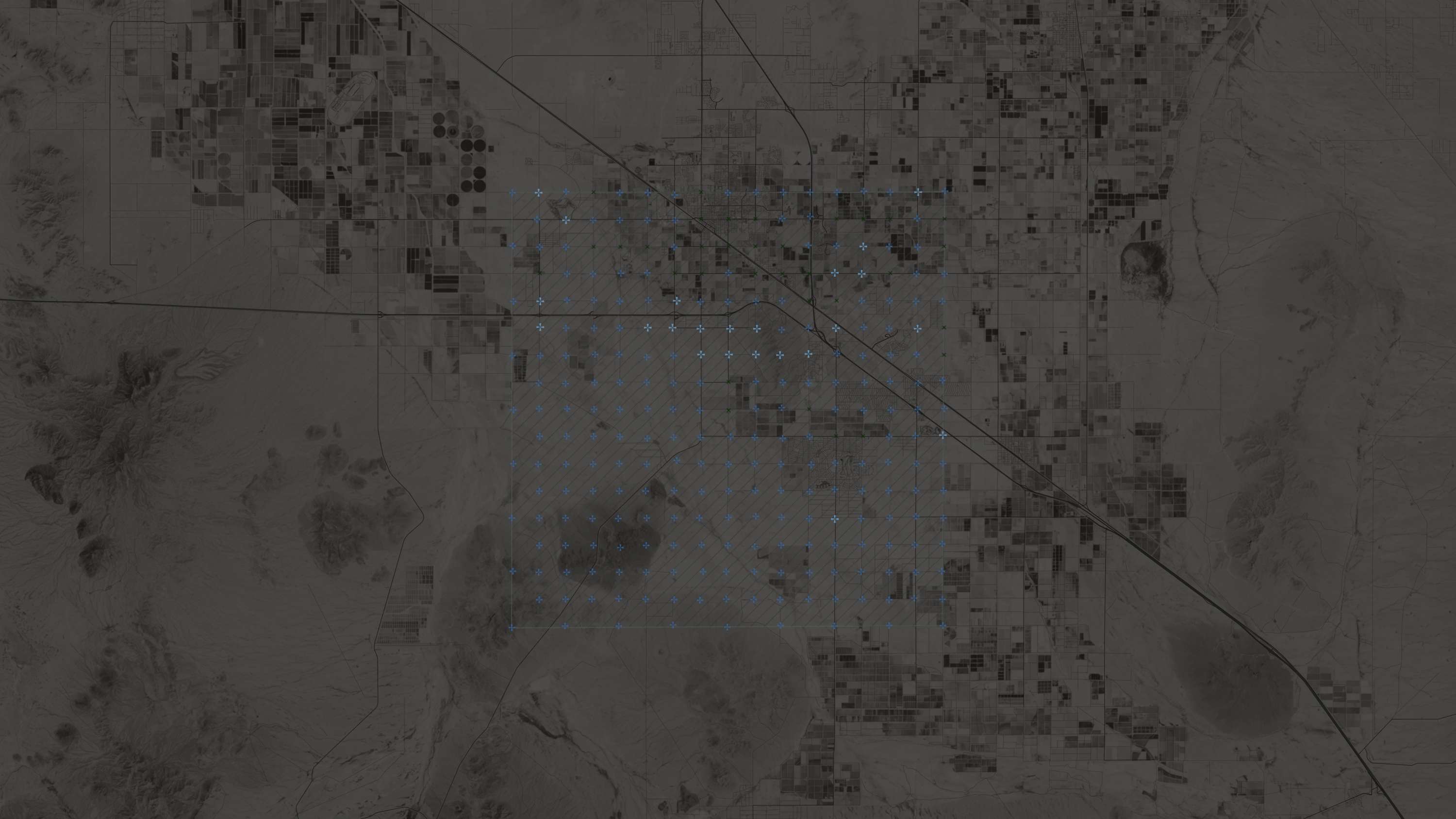
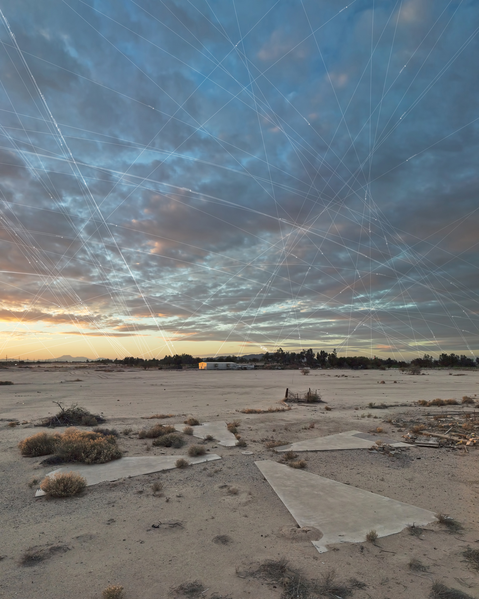
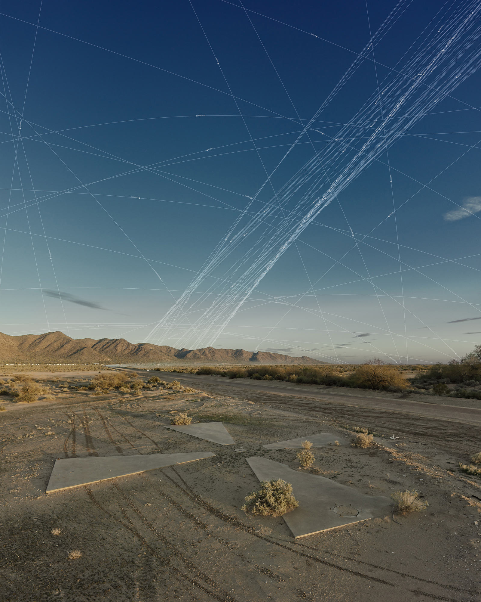
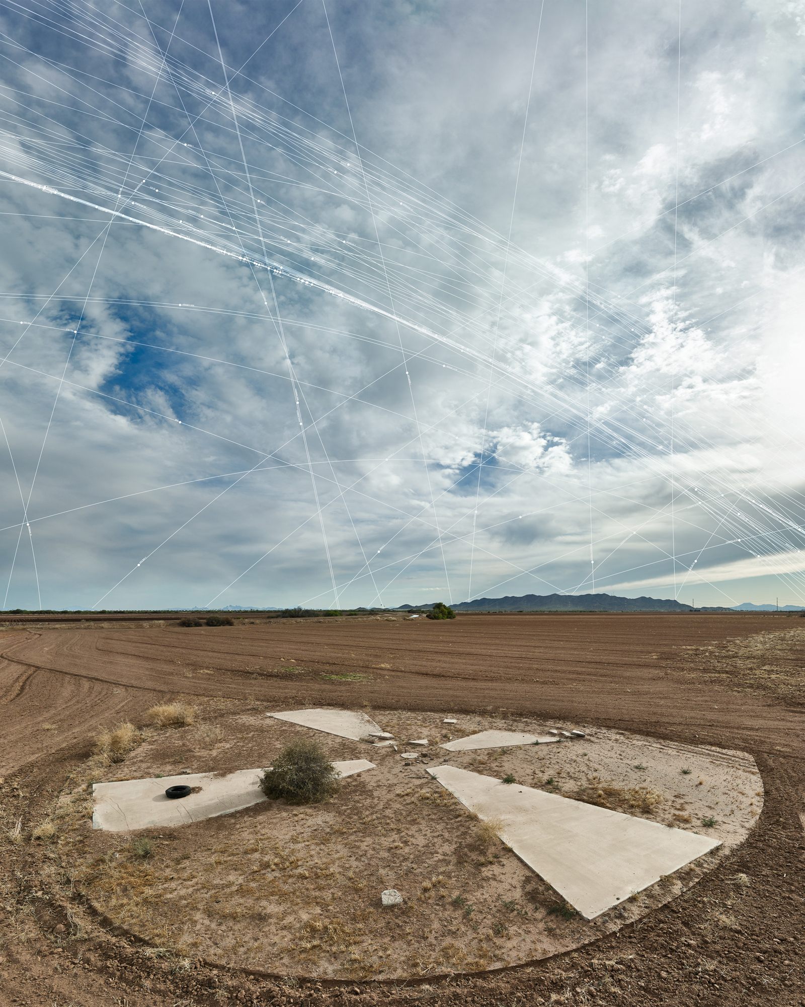
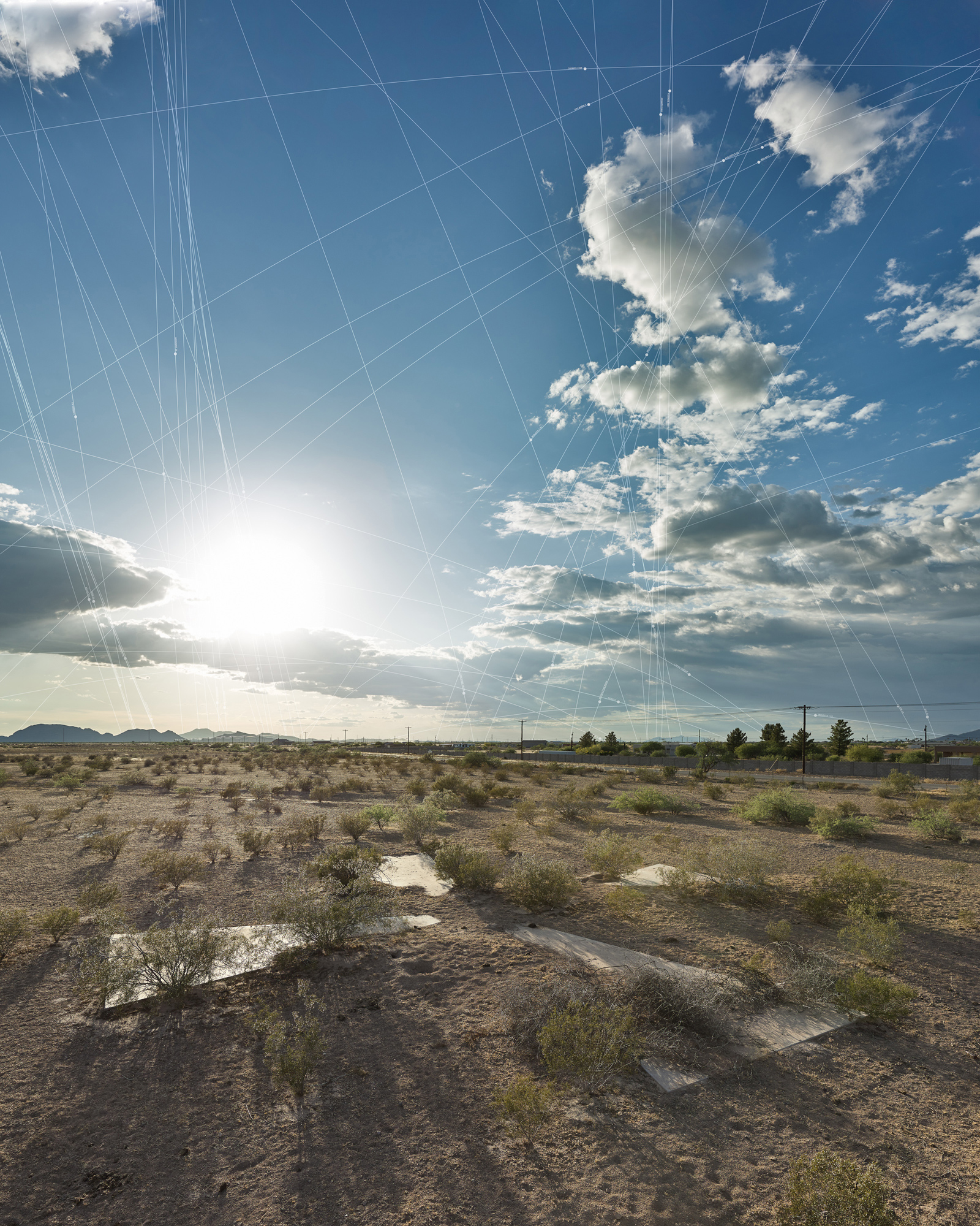
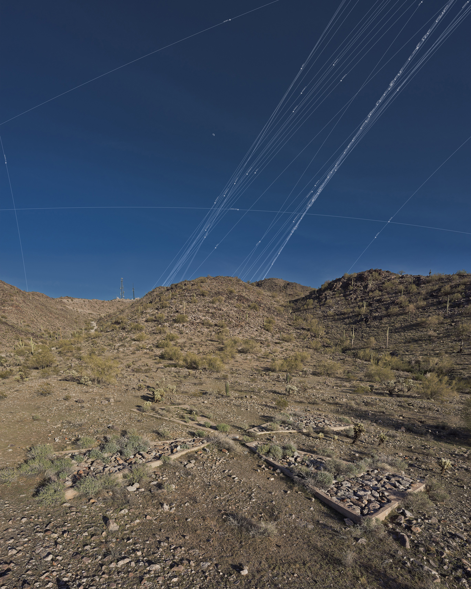
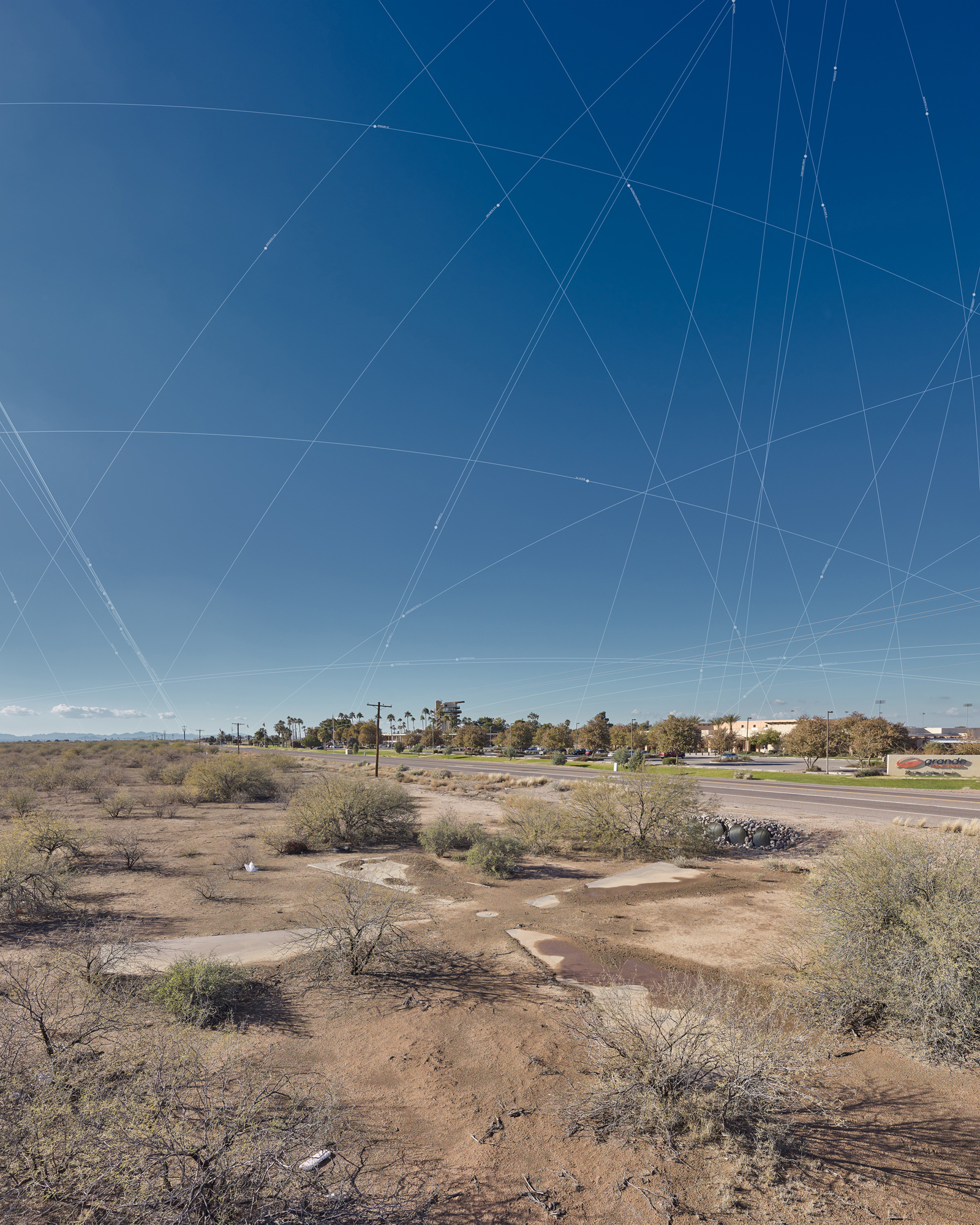
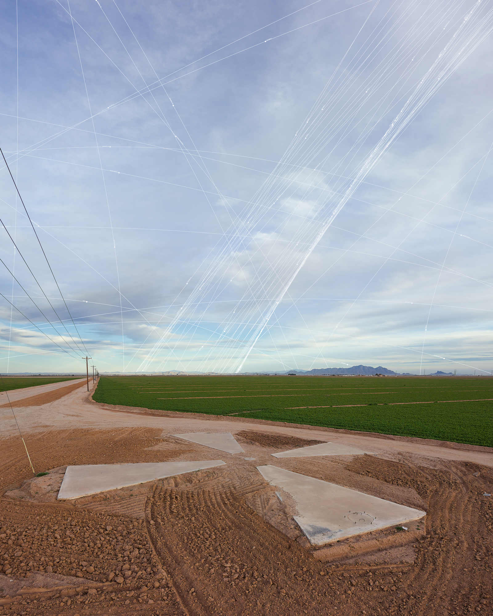
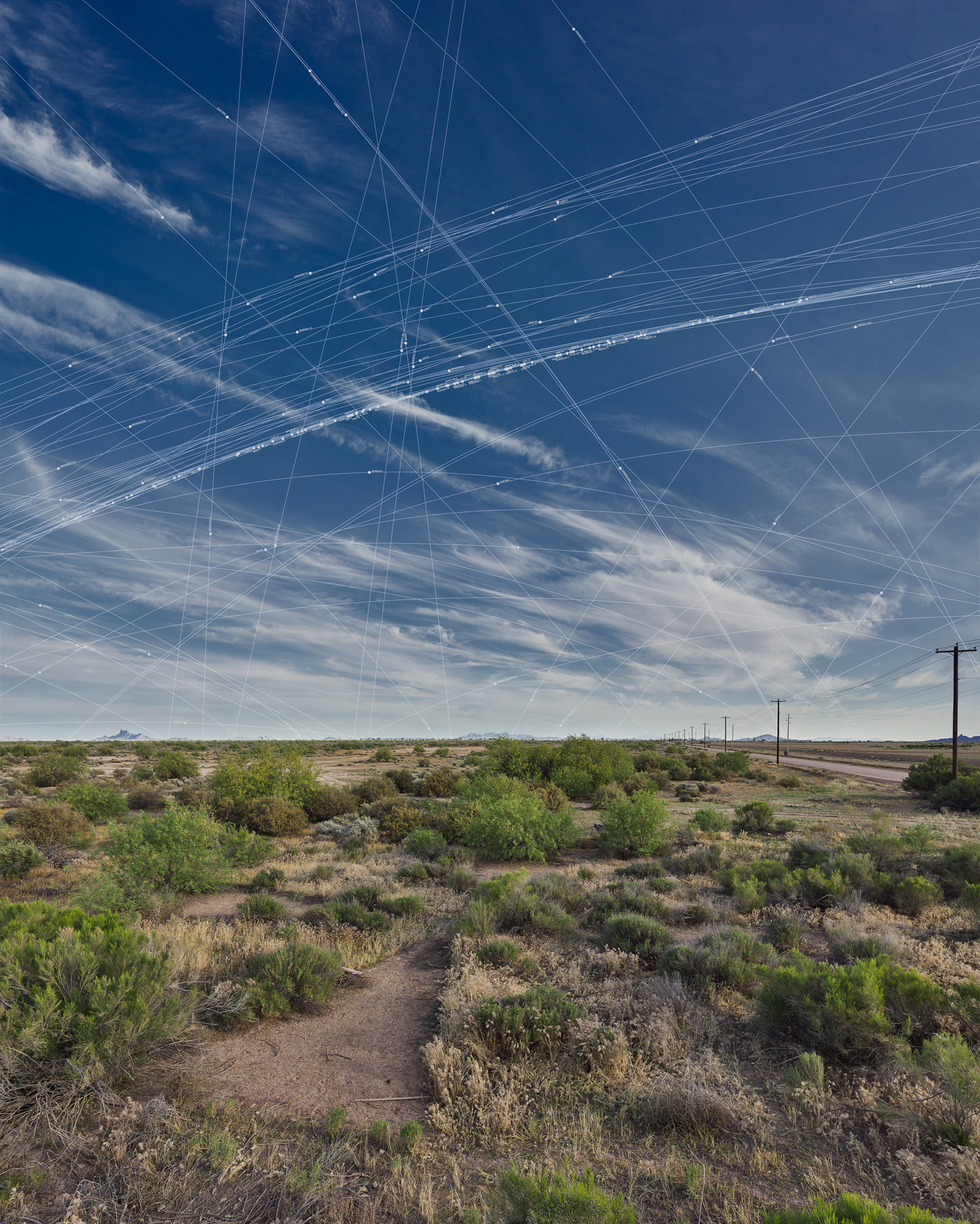
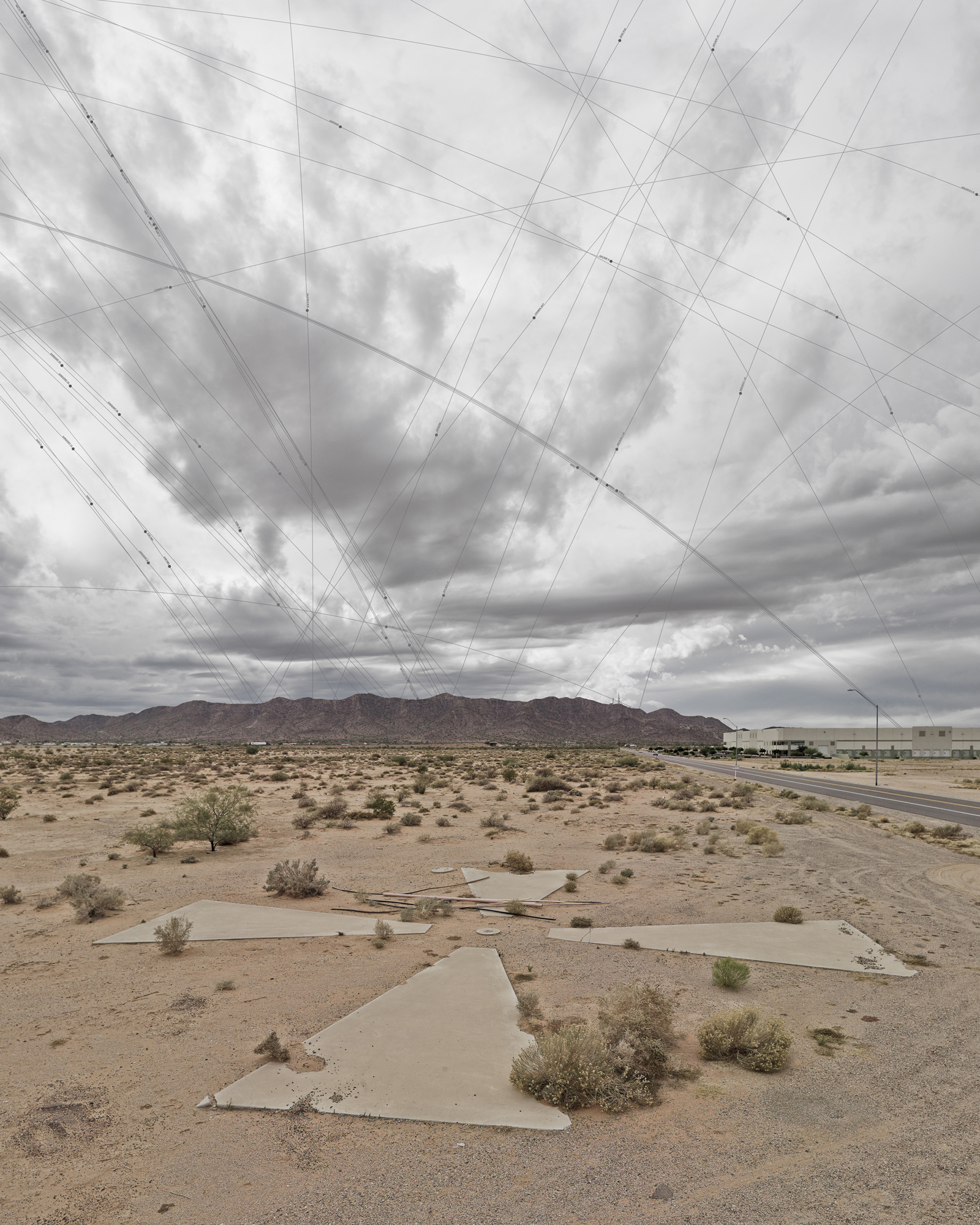
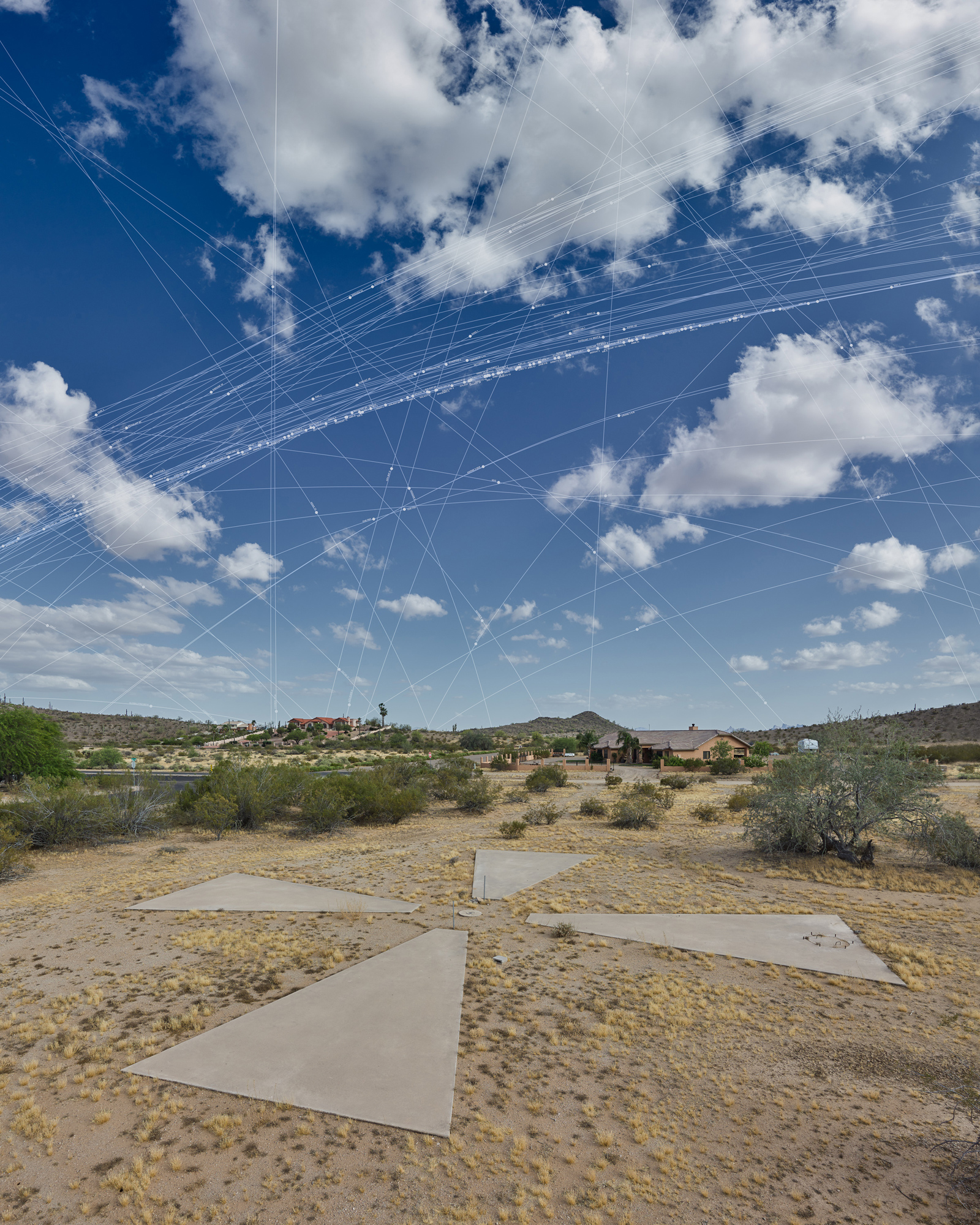
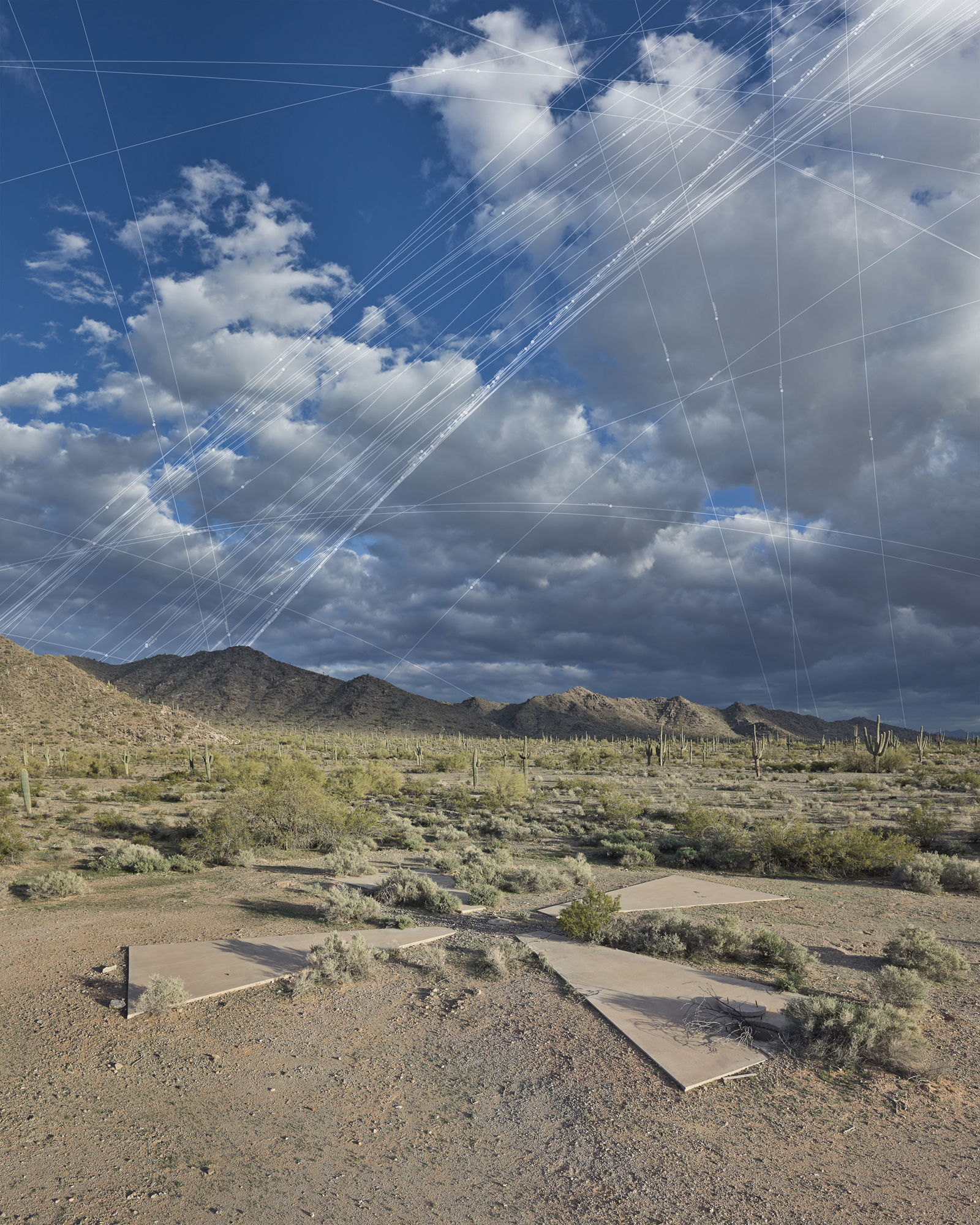
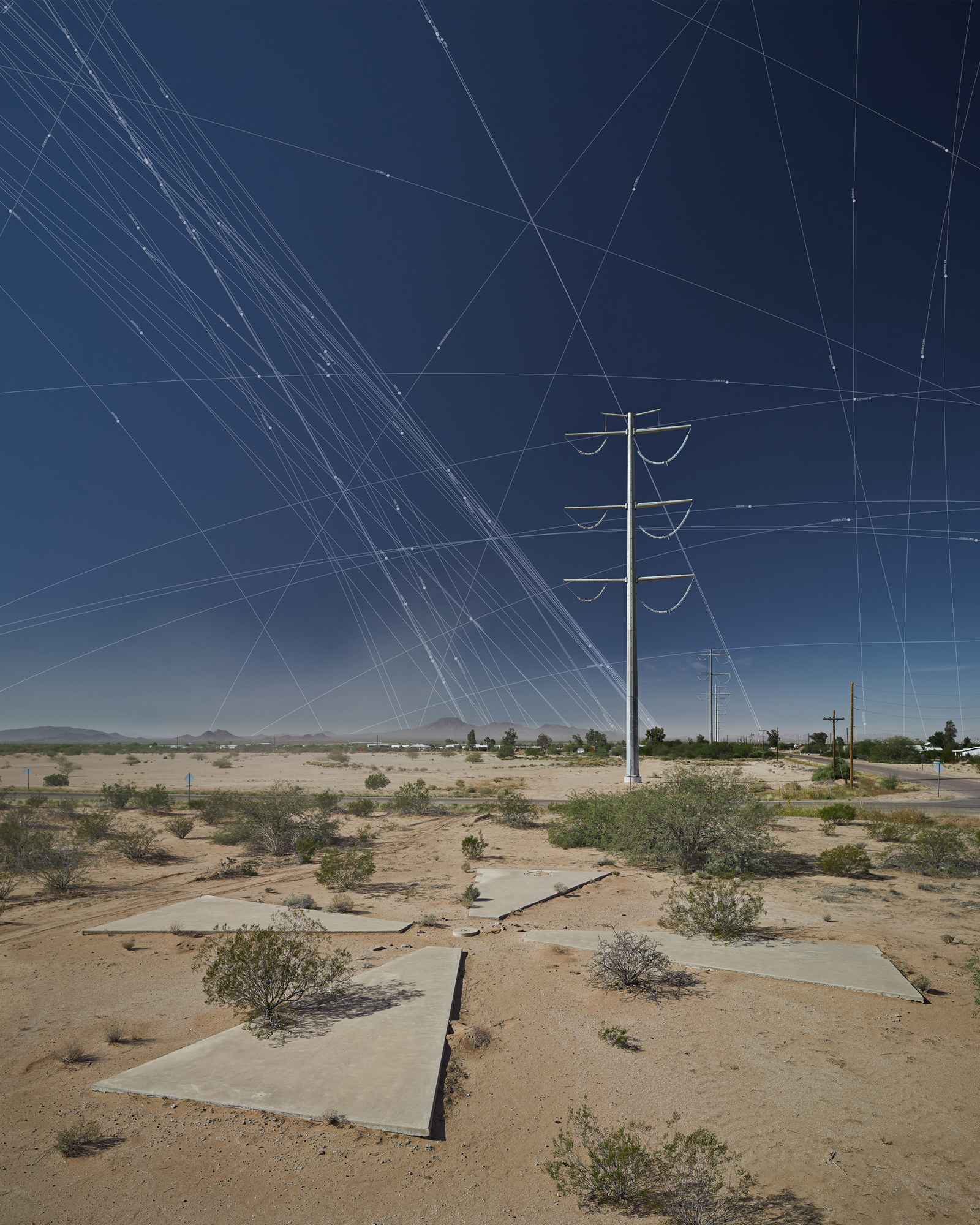
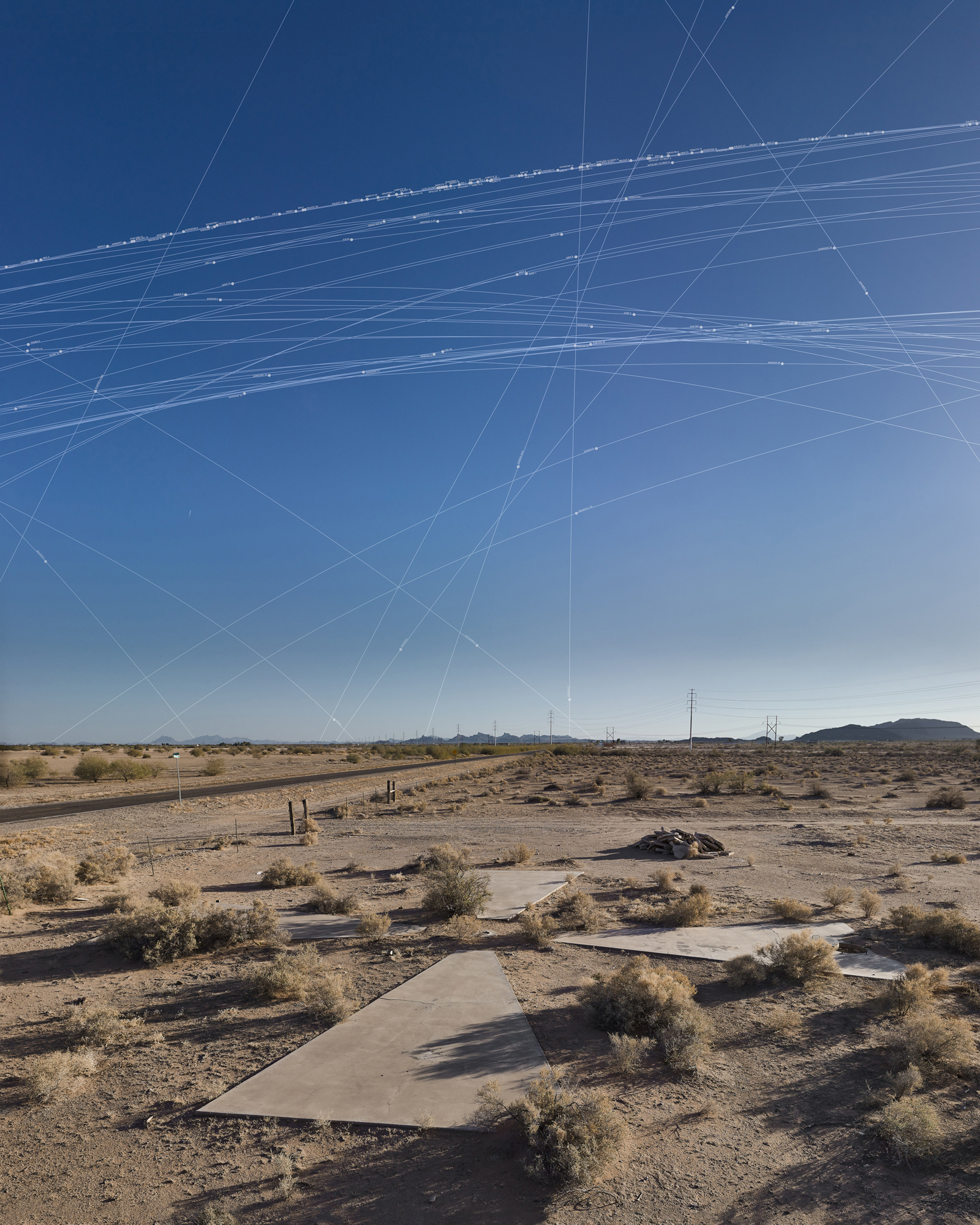
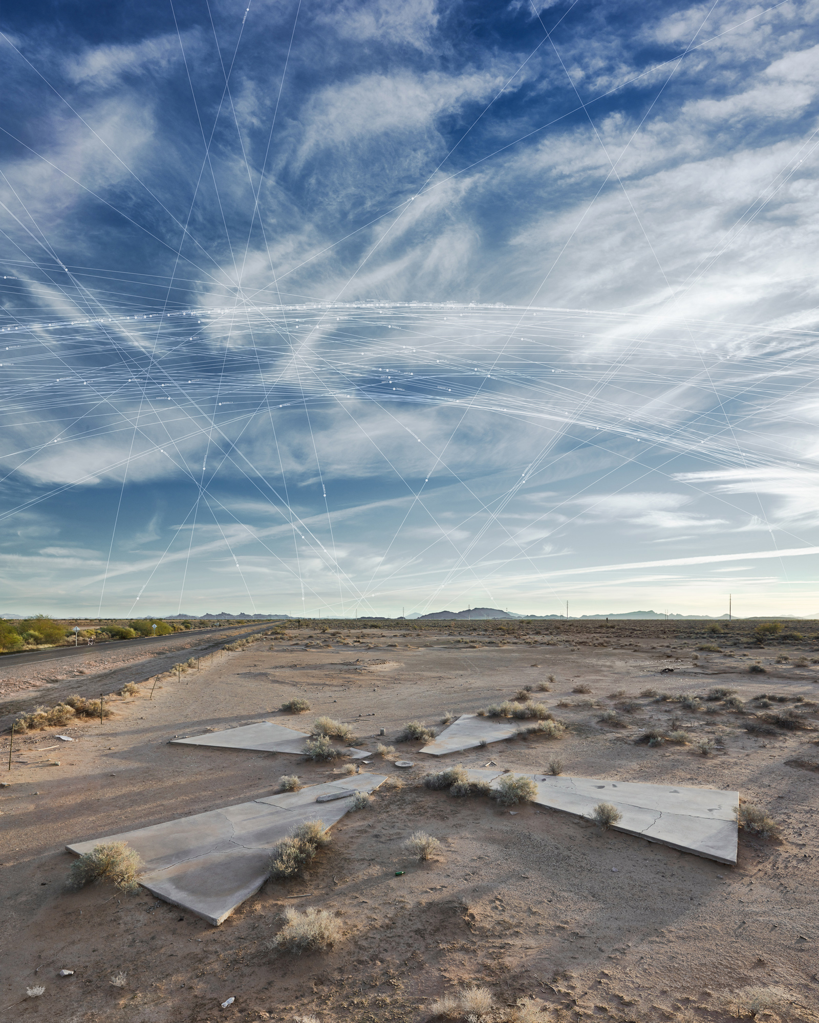
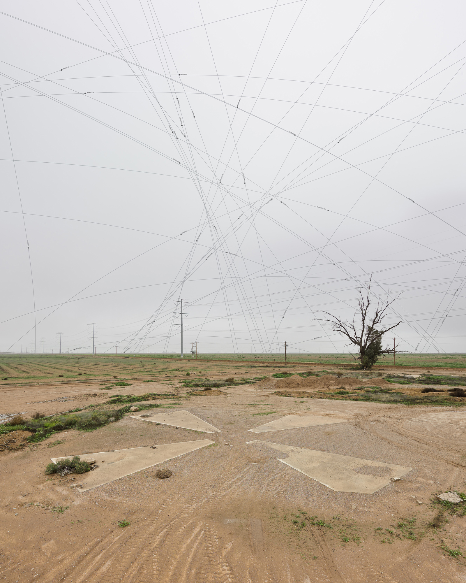
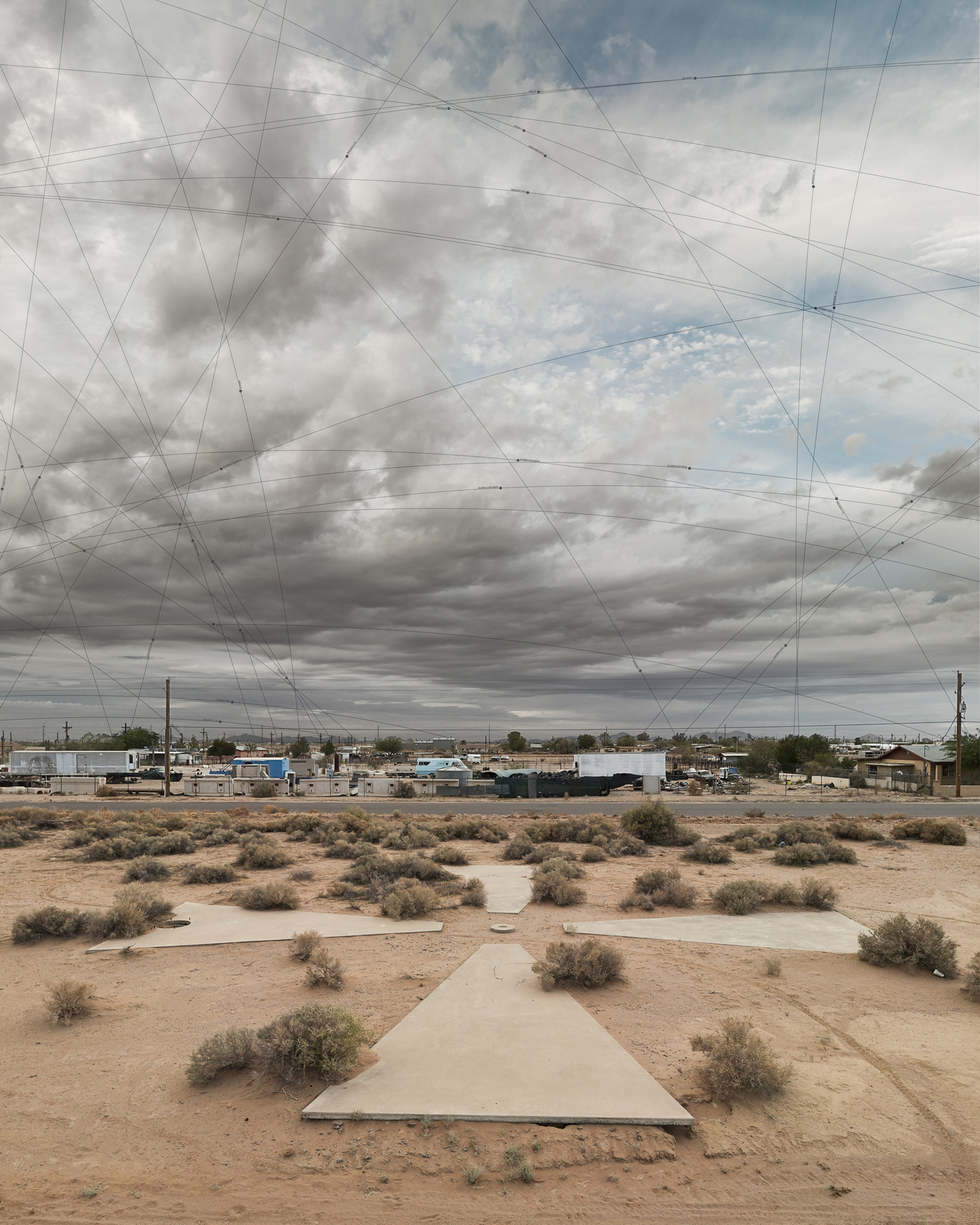
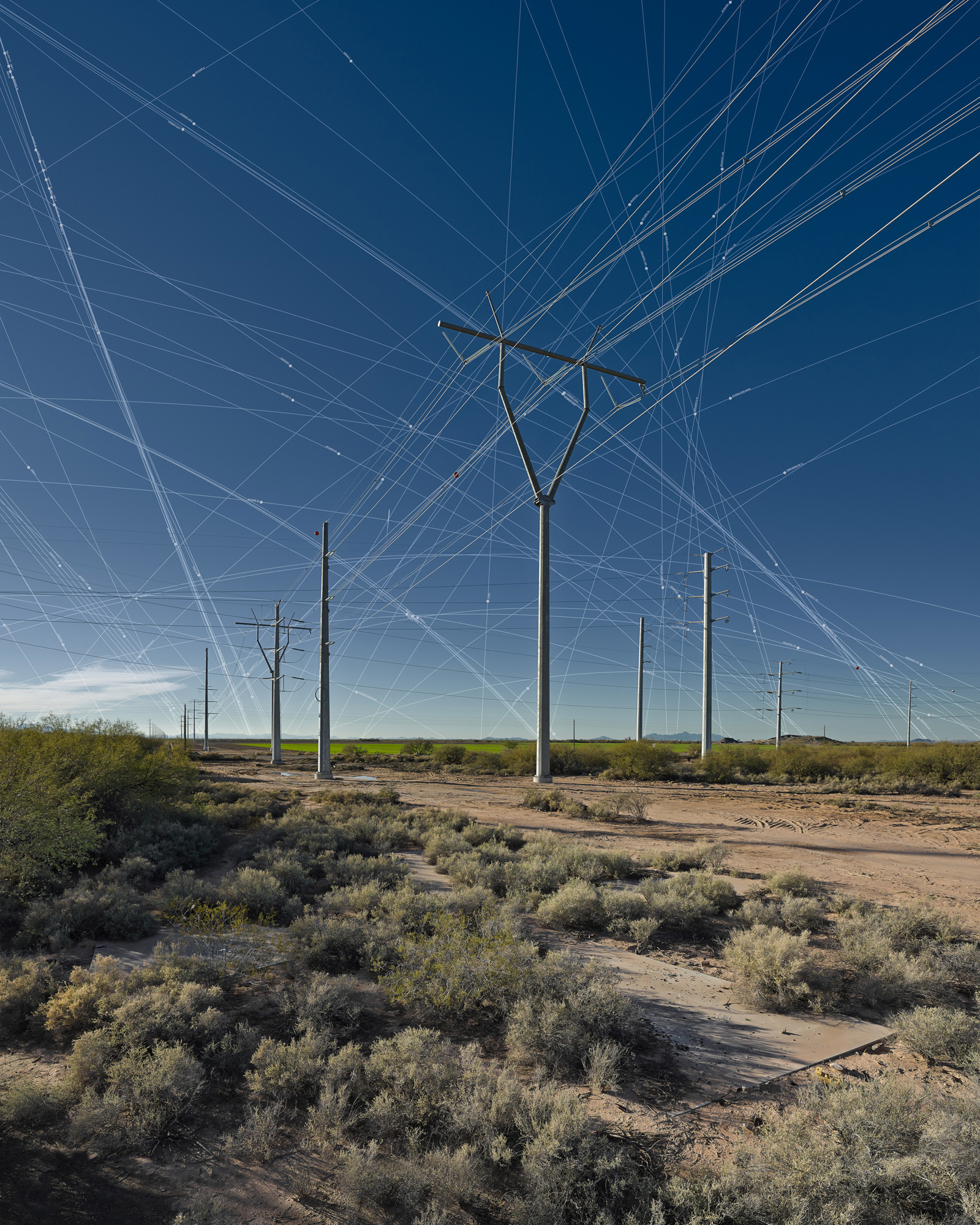
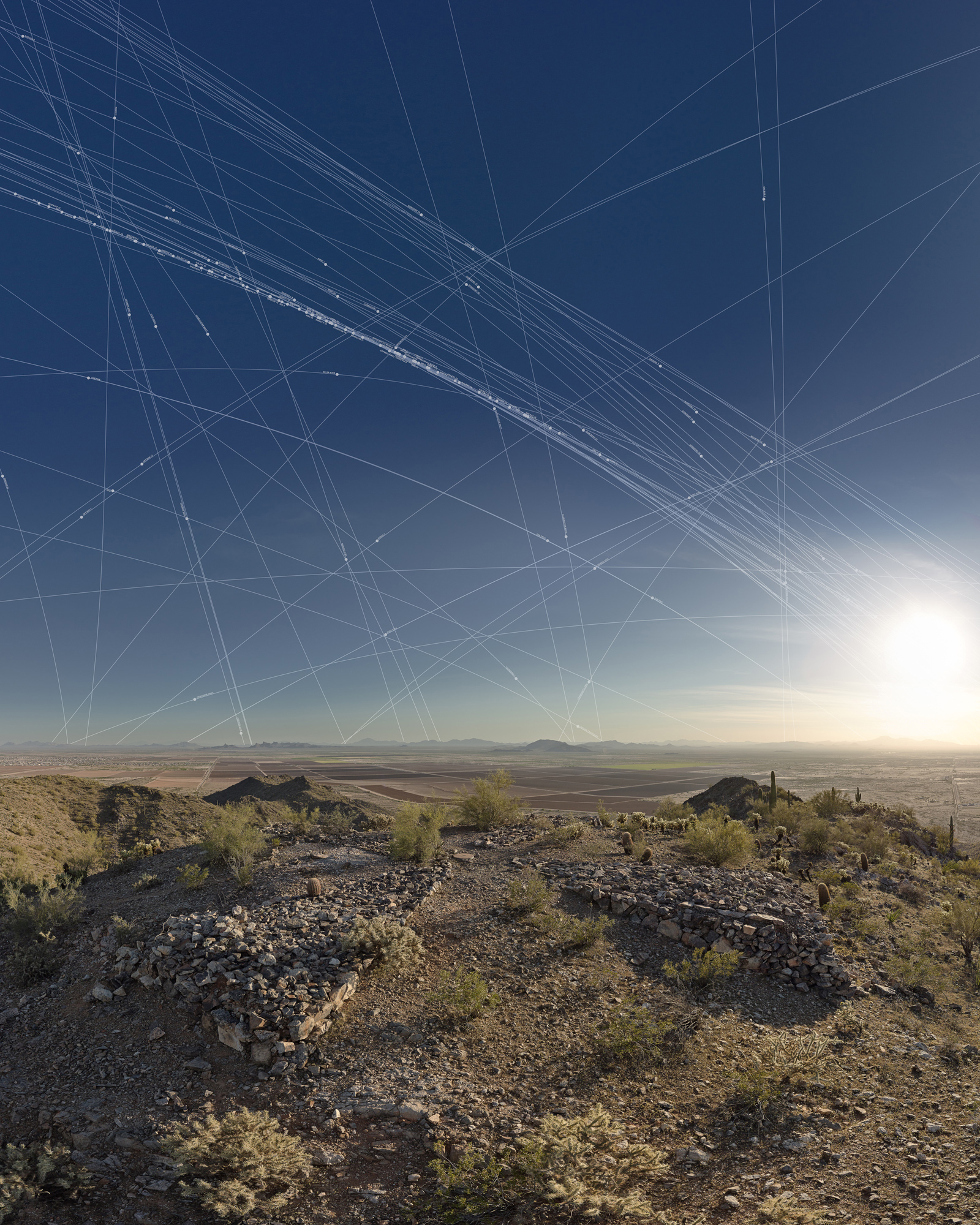
Ground Truth: Corona Landmarks, in its broadest sense, investigates an individual’s position on earth in the contemporary context of vast networks of information. We explore this situation by visualizing the expanding pervasiveness of satellite technology in relation to an historically significant set of satellite calibration targets. This system of approximately two hundred fifty-six calibration targets within the Sonoran Desert were created as part of a secret surveillance program in the mid-1960’s. The joint CIA/Air Force classified project known as Corona was a photo-reconnaissance program based on the recovery of physical capsules of ejected film and produced the world’s first maps of earth from space. The sixty-foot diameter concrete forms we photograph are located one per mile within a sixteen square-mile grid, designed as an array of ground truth markers. We are intrigued by the way that these markers of space have become markers of time, representing a poignant moment in geopolitical and technologic social history.
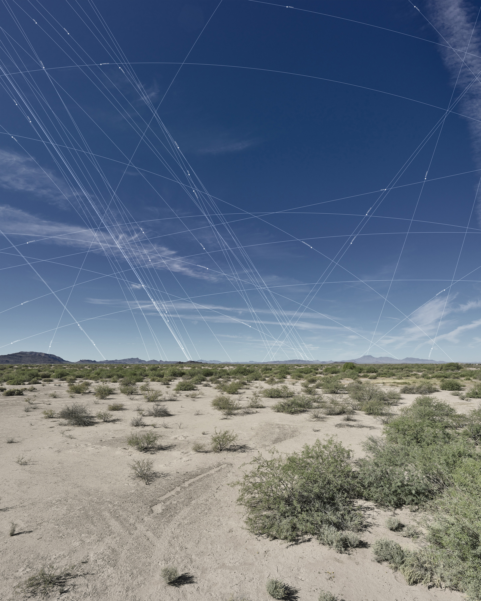
We privilege the skies in each of our compositions to give visual weight to the density of what is imperceptible miles above us. To further engage this idea, we map the specific satellites present in the sky at each site at the moment of photographing, using a satellite tracking application. We enjoy the way that these myriad points and orbital arcs emphasize the ubiquity of this contemporary technology encircling the globe. We explore the remains of Corona architecture as demarking a rich anthropologic moment evidencing the human desire to see from above.